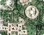
ISRO , Indian space & research organization has launched Bhuvan, a satellite mapping tool similar to Google Earth and Wikimapia on 12th August 2009. Bhuvan gives you an easy way to experience, explore and visualize IRS images over Indian region.
Bhuvan is a geoportal that provid es medium to high resolution satellite imagery of virtually the entire India over the internet. You can “fly” around using mouse and keyboard on a simple desktop computer with virtual globe in front draped with IRS images over Indian region. Many other features are built in, including 3D terrain and information on many thematic data.
Bhuvan is a free web based image portal. Most Image visualization programs are very expensive and complex. Bhuvan provides a fast and friendly way to look at IRS satellite data and thematic information in geographic context, which is invaluable for management, planning and visualization.
“With Bhuvan we will be able to produce very local information which will be specific to only to our own country. This information available from this mapping system will be useful in addressing very local problems like floods, famines, infrastructure development, education and much more,” said ISRO chairman Dr G Madhavan Nair.
Multi-resolution imag es from multi-sensor IRS satellites of India is seamlessly depicted through the Bhuvan web portal by enabling a common man to zoom into specific area of interest at high resolution. Bhuvan brings a whole lot of uniqueness in understanding our own natural resources whilst presenting beautiful images and thematic vectors generated from varieties of geospatial information. Bhuvan will also attempt to bring out the importance of multi-temporal data and to highlight the changes taking place to our natural resources, which will serve as a general awareness on our changing planet. There are lot more special value added services which will be enabled onto the web portal in due course of time and each one of those services are going to be unique to preserving and conserving our precious natural resources through public participation. We are sure the common man will get rich benefits from these Indian geospatial data services in days to come.
Bhuvan can take closer pictures of the Indian Subcontinent as compared to the Google Earth. Bhuvan is capable of taking a zoom level of up to 10 meters, while Google Earth features a zoom level of up to 200 meters.
Unlike Google Earth, however the Bhuvan application will not be downloadable and will not allow users to host content in the near future. It is not yet ready for Mac OS and Linux. But, at the moment Bhuvan can run only on windows system and is optimised for IE 6. or higher with 1280×1024 resolution.
One will be able to see the following data using Bhuvan:
- Satellite imagery (LISS III , LISS IV along with metadata and Multi- temporal Data from OCM & AWiFS)
- Value added information (NADAMS – National Agricultural Drought Monitoring System), Output of flood studies for certain areas
- Thematic information (Wastelands, Soils, watershed,water resources related maps)
- Base layers ( administrative boundaries, transport layers, water bodies, etc)
- Census information
- Metadata
Advanced functionalities to be provided in future versions
- Urban Design Tools (to build roads, junctions and traffic lights in an urban setting)
- Contour map ( Displays a colorized terrain map and contour lines)
- Terrain profile ( Displays the terrain elevation profile along a path)
- Draw tools (Creates simples markers, free hand lines, urban designs)
- Navigation map (to jump to and view locations in the 3D India)
It is mandatory to register to use Bhuvan. The basic version of Bhuvan is free. Once you register and you login, you will be asked to download the Bhuvan plug-in. Accept the installation of the plug-in and you are ready to use the full features of Bhuvan.
